

May 6th, 1975 Tornado Anniversary: Overview
Tuesday, May 6th, 2025 marks the 50th anniversary of the impactful Omaha tornado of 1975. Below is the first of a series of posts discussing the weather and impacts of that day.

May 6th marks the 50th anniversary of significant tornadoes in northeastern and east central Nebraska. The Omaha tornado killed 3 individuals, injured more than 100, and created more than 100 million dollars of damage, which in 1975 made the event one of the top 3 most expensive tornadoes in United States history.
Highly visible and well photographed, perhaps the most stunning scenes of the tornado are from photographs taken from the Aksarben horse racing track, where approximately 8000 individuals were gathered for afternoon races. The path of the tornado missed the track by about 10 city blocks. Notable buildings within the path of the tornado included the Bergan Mercy hospital, the Nebraska Furniture Mart, and Creighton Prep High School. Also included in the path, among many, many structures, was the building now home to Good News Church.
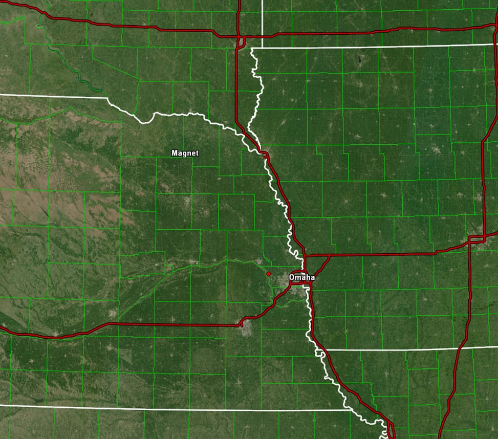
Early afternoon tornadoes created significant damage first in the tiny northeastern Nebraska hamlet of Magnet, and then, a couple of hours later, the infamous Omaha tornado ripped through the heart of the largest city in Nebraska.
These thunderstorms developed in a small area of warm, humid atmospheric conditions favorable for severe thunderstorms to develop and mature, as represented by the surface weather analysis below.

To the west of this air mass was a dryline boundary, denoted by brown dashes on the above map, separating humid Gulf air of eastern Nebraska from the dry intermountain air of central and western Nebraska. To the east and northeast of this air mass, denoted by the red line, a warm front extended across northern Missouri, curving northward near the Missouri River, and extending north towards the surface low pressure in western South Dakota. The humid, unstable air mass favorable for thunderstorms is shaded in green, with the richest moisture - surface dew point temperatures of at least 65 degrees Fahrenheit - a slightly darker shade of green.
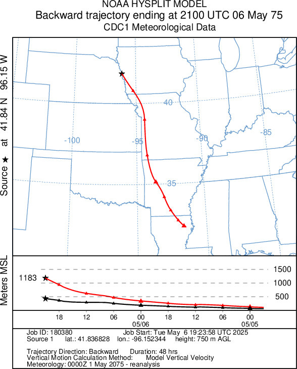
48 hours prior to the thunderstorms, surface dew point temperatures in eastern Nebraska were only reaching the upper 30s, much too low for strong tornadoes. However, the air mass in eastern Nebraska would change rapidly over two days. Air parcels in southern Louisiana and Mississippi - rich in Gulf humidity - were rapidly advected northward by strong southerly winds. By the morning of the 6th, the moisture content of the eastern Nebraska atmosphere resembled that of the southern Gulf states, with dew point temperatures in the mid 60s all the way to Omaha. The NOAA HYSPLIT model shows the path that air parcels took northward from Louisiana during those 48 hours, approximately along what is now the Interstate 49/29 corridor northward through western Arkansas, Missouri, and Iowa.
Though only a narrow band of air favorable for tornadoes existed near the Missouri River, this pocket of unstable air advanced in a similar direction and at a similar speed as the thunderstorms that were being created. The concurrent northward motions of both thunderstorms and the favorable air mass allowed these thunderstorms to remain in warm, humid air for several hours. The consistent access to humid air fueled the powerful updrafts and allowed the storms to fully develop and mature into violent supercells.
In the coming days, this blog will explore in more depth the meteorological concepts that made the atmosphere on 6 May 1975 so volatile, including the wind profile throughout the atmosphere, the temperature and moisture characteristics of the atmosphere in eastern Nebraska, and what we can know about the behavior of the thunderstorms themselves. I will also tell stories from Good News Church about how the church was rebuilt following the tornado and what the church means to the Omaha community today. This series of discussions will culminate with a longer form article summarizing stories and celebrating both meteorologists and Good News Church.
I will not attempt to recreate the play-by-play of the tornado itself - I believe that KMTV-3 Omaha on-air talent and weather historian Joseph Meyer has written the definitive story of this tornado track. His work can be found at the following link:
https://www.3newsnow.com/weather/weather-history/may-6-1975-the-omaha-tornado
Source material:
The plotted surface weather data, pre-analysis, is courtesy of Iowa State University, and similar data can be found by searching the following directory:
https://mesonet.agron.iastate.edu/archive/data/
NOAA HYSPLIT trajectory models - forecasts and hindcasts - can be run by users through the Air Research Laboratory webpage:
https://www.ready.noaa.gov/HYSPLIT.php